shrine to the prophet of americana

#geography (151 posts)

Some really fascinating decisions in the latest Mr. Beast video: Mr. Beast recognizes Russia’s claim to the Crimean...

radiofreederry:

Some really fascinating decisions in the latest Mr. Beast video:

Mr. Beast recognizes Russia’s claim to the Crimean peninsula

Mr. Beast recognizes the State of Palestine

Mr. Beast recognizes Somaliland

Mr. Beast recognizes the Taliban government of Afghanistan

Mr. Beast does NOT recognize Taiwan

Mr. Beast uses the flag of Georgia (the state) for Georgia (the country)

Tagged: geography vexillology

Global antineutrinos emitted from nuclear power stations

mapsontheweb:

Global antineutrinos emitted from nuclear power stations

Did we never build any in Greenland and just ship in fuel?

After all those Øs in Tom Clancy novels!

Tagged: geography greenland Tom Clancy

The 26 major river basins of the world

kawaiite-mage:

mapsontheweb:

The 26 major river basins of the world

been looking to found a major early civilization, this helps a lot

Tagged: geography

ppl managing to live where they grew up is really bizarre to me

tardis2101:

theocseason4:

mediumsizedboy:

hakushokuwaisei:

racheldotgov:

ppl managing to live where they grew up is really bizarre to me

Hi! Croatian here. As an inland country, I found a job processing uranium. We have a lot of it.

God I wish I was processing uranium in Croatia

I think about this post every day

Hey, another Croatian here! Croatia has a coastline and I can’t find a single mention of uranium in Croatia. I don’t know what kind of paralel universe this person is from.

Tagged: geography Croatia actually has a LOT of coastline as a fan of D'annunzian Fiume I know this wasn't inevitable

Kawase Hasui  The complete set of Eight Views of Korea (Chosen hakkei) Eight woodblock prints, each signed and sealed Hasui, and...

nobrashfestivity:

Kawase Hasui 
The complete set of Eight Views of Korea (Chosen hakkei)

Eight woodblock prints, each signed and sealed Hasui, and published for Kansai Bijutsusha by Watanabe Shozaburo, 1939

The designs comprising:
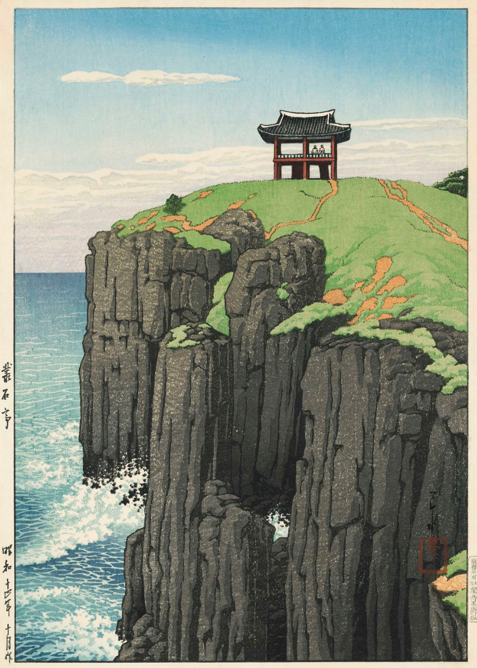
1. Chongsokjong, Kyongju (Keishu Sosekitei), October 1939
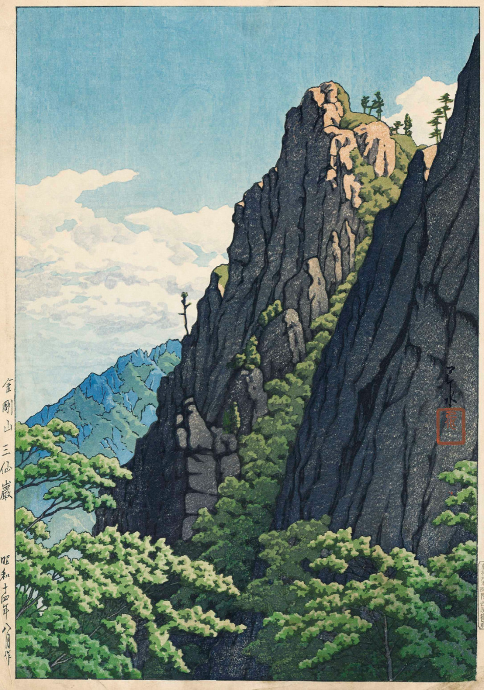
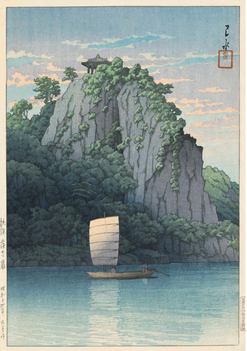
2. Samburam rock, Kumgang Mountain (Kongosan Sansengan), August 1939
3. Pulguk Temple, Kyongju (Keishu Bukkokuji), September 1939
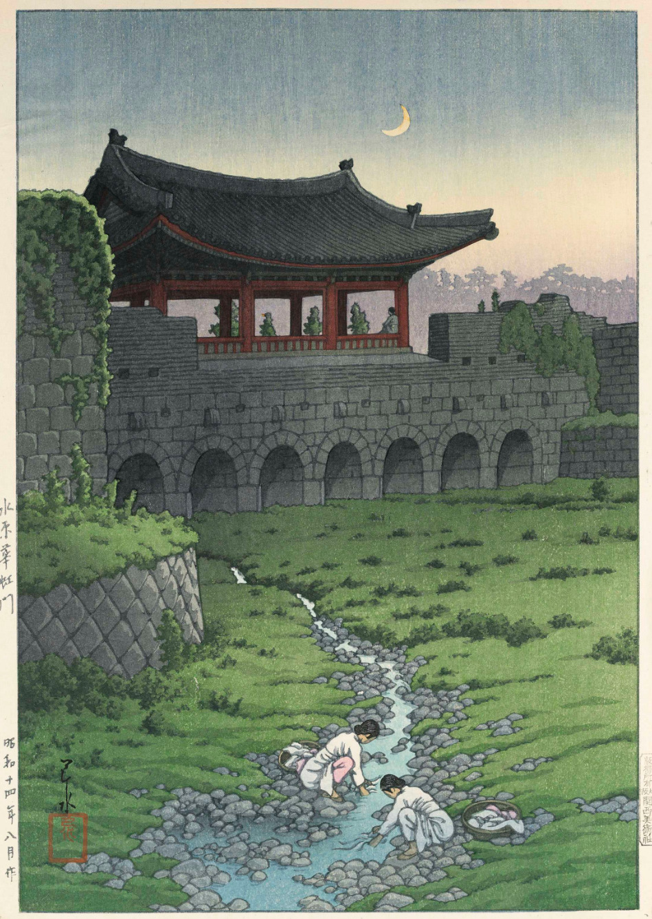
4. Hwasa Gate, Suwon (Mizuhara Kakomon), August 1939
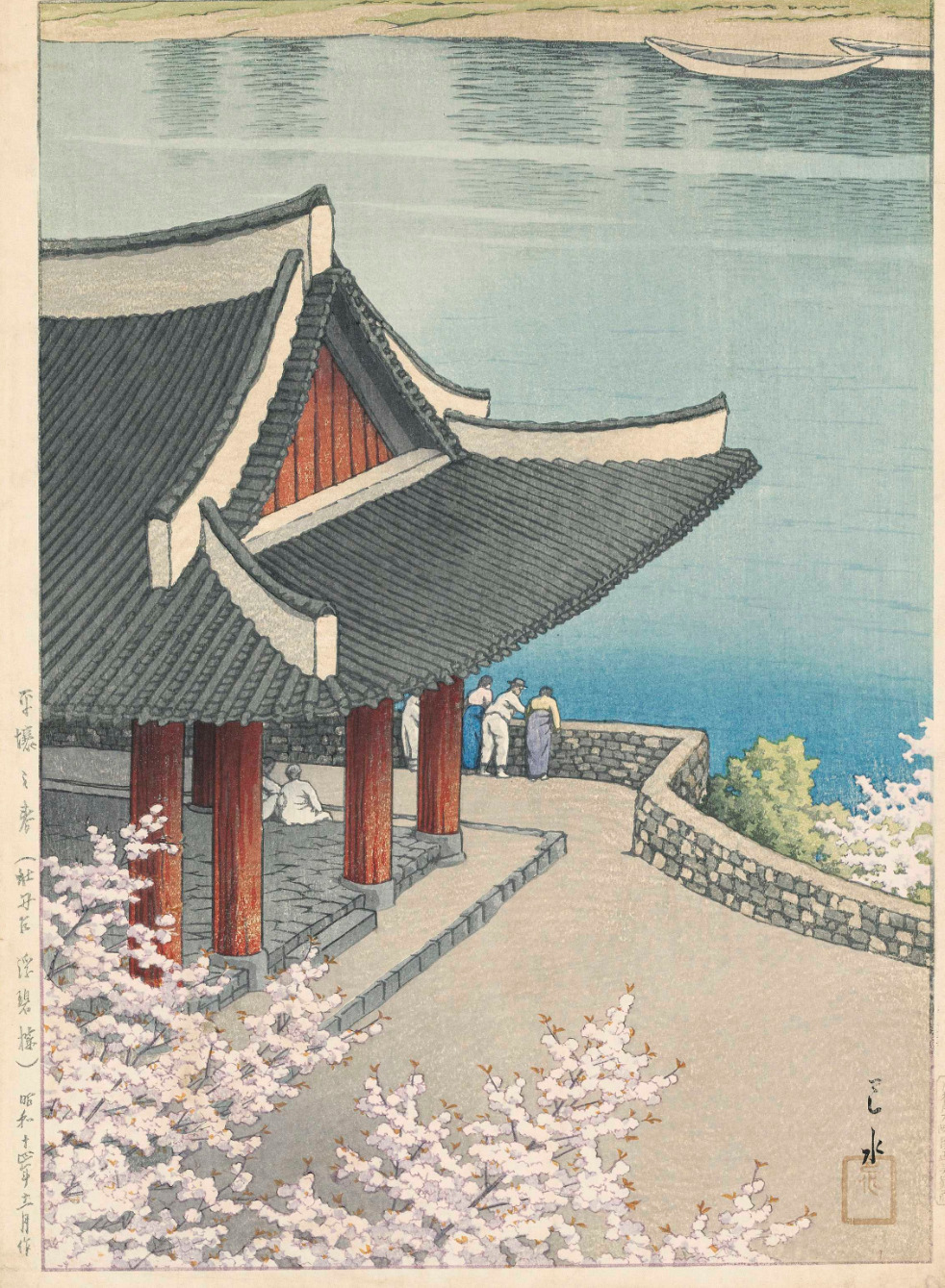
5. Spring at Pubyong Pavilion, Modan Viewpoint, Pyongyang (Heijo no haru (Botandai Fusekiro)), 1939
6. Nakhwa, Puyo (Fuyo Rakkagan), September 1939
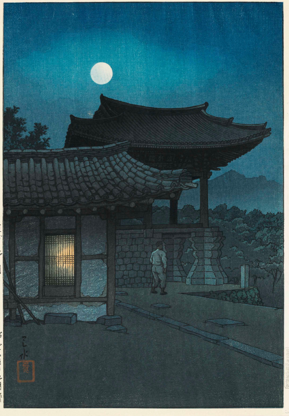
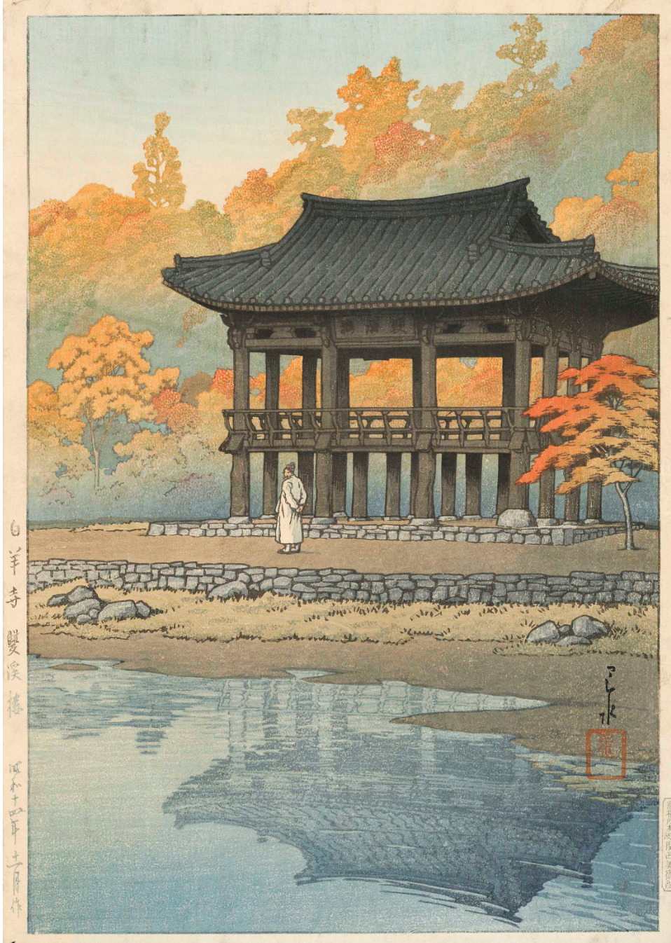
7. Sanggye Pavilion, Paekyang Temple (Hakuyoji Sokeiro), November 1939
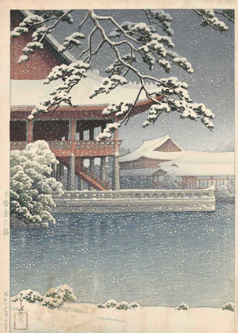
8. Kyonghwe Pavilion, Kyongsong (Chosen hakkei, Kyojo Keikaro), November 1939
Each approx. 42.5 x 29.2 cm.

more

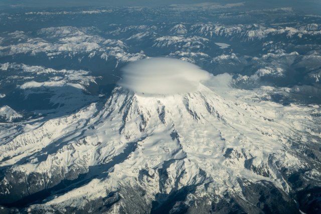
One thing Ghosts of Tsushima was good at dramatizing is that SE Asia is full of severe mountains going straight into the ocean, far more so than the west coast of the US which is itself far younger and more severe than the heavily eroded Appalachians of the East Coast

Tagged: geography

By #hoffshots : Trying to capture a scene when flying by at 500 mph isn’t always easy. But sometime the skies open up, the...

dopescissorscashwagon:

By #hoffshots : Trying to capture a scene when flying by at 500 mph isn’t always easy. But sometime the skies open up, the routing is perfect, and it all comes together. This was one of those times flying by mount rainier with the elusive cap cloud perched on top.

Tagged: cascadia geography

Something I see underemphasized is that car dealerships give off huge amounts of property, sales, and business taxes and from a...

kontextmaschine:

Something I see underemphasized is that car dealerships give off huge amounts of property, sales, and business taxes and from a public revenue standpoint are essentially money fountains, so keeping dealership owners happy in place is not only clutch for local politicians as political actors, but as the legitimately elected guardians of their particular electorates’ interests

If you see a stretch of road with a bunch of dealerships in a row it is inevitably right on the edge of a jurisdictional border (perhaps a historic pre-annexation one!) and there is a reason they’re all on the same side of it.

Tagged: geography

which GIS maps please like can I just see them online easily without paying

Anonymous asked:

which GIS maps please like can I just see them online easily without paying

Portland has a public interface at PortlandMaps.com

Tagged: portlandportlandportland web 1.5 geography

Between GIS and Zillow maps you can trivially figure out how your neighborhood is changing in the upcoming 6 months ahead of...

Between GIS and Zillow maps you can trivially figure out how your neighborhood is changing in the upcoming 6 months ahead of time

Tagged: geography gentrification

Percentage of the population which lives in the capital city! by dach_maps

mapsontheweb:

Percentage of the population which lives in the capital city!

by dach_maps

Everyone in Vatican City, San Marino, and Monaco lives there. Fair enough.

Tagged: geography

Basically at any time you are in Japan, you are at the coast (the plains count), in the mountains, in the foothills, on...

Basically at any time you are in Japan, you are at the coast (the plains count), in the mountains, in the foothills, on Hokkaido, on a minor outlying island, or at Lake Biwa.

Tagged: meanwhile in japan geography

Been using the Portland GIS system to learn the ownership of all the properties around me to get clues on how redevelopment's...

Been using the Portland GIS system to learn the ownership of all the properties around me to get clues on how redevelopment’s gonna proceed.

As recently as the 2000s you had to go down to the courthouse and look this stuff up on paper!

Tagged: portlandportlandportland geography

Your two options folks

centrally-unplanned:

collapsedsquid:

maxknightley:

collapsedsquid:

Your two options folks

Thoroughly mystified by the top one. “America colonized heavily by the British with a bunch of cities named after English cities” is just… America again. The bottom one at least makes sense even if it’s absurd (minus the part where the Central Powers cede a bunch of territory to Japan, an allied nation in WWI, for seemingly no reason)

The [first] map appeared on the cover of The Fatherland, a pro-German weekly paper established at the start of the war, with the title ‘New Map of the D.S.E. - Dependent States of England - Formerly U.S.A.’

It was published in response to Life magazine’s famous cover [second pic here] imagining the country conquered by the Central Powers and Japan:

As I always comment, love how both sides of the war agree “oh yeah also Japan your ostensible ally is gonna backstab you and take California”, a totally reasonable and justified fear in the 1910’s for sure.

Why are they agreed that Americans will be put on a reservation in specifically El Paso?

Tagged: geography amhist

Just found out the EPA has released Level IV ecoregions for the whole USA. 967 of them. My brain is liquefying in pure joy. Look...

headspace-hotel:

paleodictyoptera:

Just found out the EPA has released Level IV ecoregions for the whole USA. 967 of them.

My brain is liquefying in pure joy. Look at the colors!

whoaaaaaa that’s a lotta biome

Tagged: geography

1529 Map of the Americas by Diego Ribero

mapsontheweb:

1529 Map of the Americas by Diego Ribero

That’s interesting, it implies Pacific coast exploration began from shipyards built on the far side of the isthmus of Darien? I don’t have much background on the period.

Tagged: history amhist geography

What does “World Tour” actually mean? by u/OkSwims Keep reading

mapsontheweb:

What does “World Tour” actually mean?

by u/OkSwims

Keep reading

Canary Islands getting more than I’d expect

Tagged: geography

Tagged: geography kontextmaschine does hollywood

why is los angeles where los angeles is

kontextmaschine:

rustingbridges:

why is los angeles where los angeles is

The first transcontinental railroad ran to San Francisco, and when a southern route was built the obvious western terminus was San Diego, but San Francisco elites feared the growth of another California power center so they pulled strings to get it redirected to Los Angeles, which was originally the agricultural lands feeding a Spanish mission and had no natural port. (They first built long piers around Malibu and then an artificial breakwater-protected harbor down by Long Beach.)

Then in 1892, the city was found to sit atop a major oil field and a drilling boom ensued, then in WWI the existence of a large labor force without strong left-labor organization like elsewhere on the west coast and in coastal shipping range of the wood-producing Pacific Northwest made it ideal to spin up a military aircraft industry.

Then after WWI, the booming Mediterranean-climate city drew a lot of immigrants from post-Ottoman lands as their national restructurings wrang out, then the motion picture industry relocated there from upstate New York for the weather and to get distance from Thomas Edison’s IP-enforcing goons, then in WWII that defense aerospace industry got even bigger, carrying the region through the Cold War.

But so why there specifically is that downtown (which was not particularly central to the city since its auto-oriented postwar expansion) is on the banks of the seasonal Los Angeles River, which irrigated the land to grow crops for the mission at the northern mouth of the San Fernando Valley.

Tagged: geography

New York State place names. I am a wanker who creamed themself at "Rutherford Road" and can sympathise with naming new towns...

abilitiesconsideredunnatural:

New York State place names.

I am a wanker who creamed themself at “Rutherford Road” and can sympathise with naming new towns after classical locations, as confusing and disappointing as it is to hear Americans talk about them and realise they’re just on about someplace on the East Coast… but Troy?! my god what the fuck did you have against that place?

I don’t even resent our English places names too much, I bet their Newcastle and Ipswich are shit too and we can bond, though obvious Scottish ones are better.

But my god if you’re going to go full wanker, thing about the associations. Did you want that town to suffer? Did they serve you bad food?

Someone in charge of establishing the Military District, the part of upstate New York given to Revolutionary War veterans, liked classical Greece. That’s where Seneca and Attica and Ithaca and Utica come from.

Tagged: geography

i’m curious which river is “the river” for you guys? for me it’s the rhine

abba-enthusiast:

i’m curious which river is “the river” for you guys? for me it’s the rhine

I guess the Willamette, the Columbia is right there too but I never go to the other side of it; it might as well be a seashore.

In childhood, the Delaware.

Tagged: geography