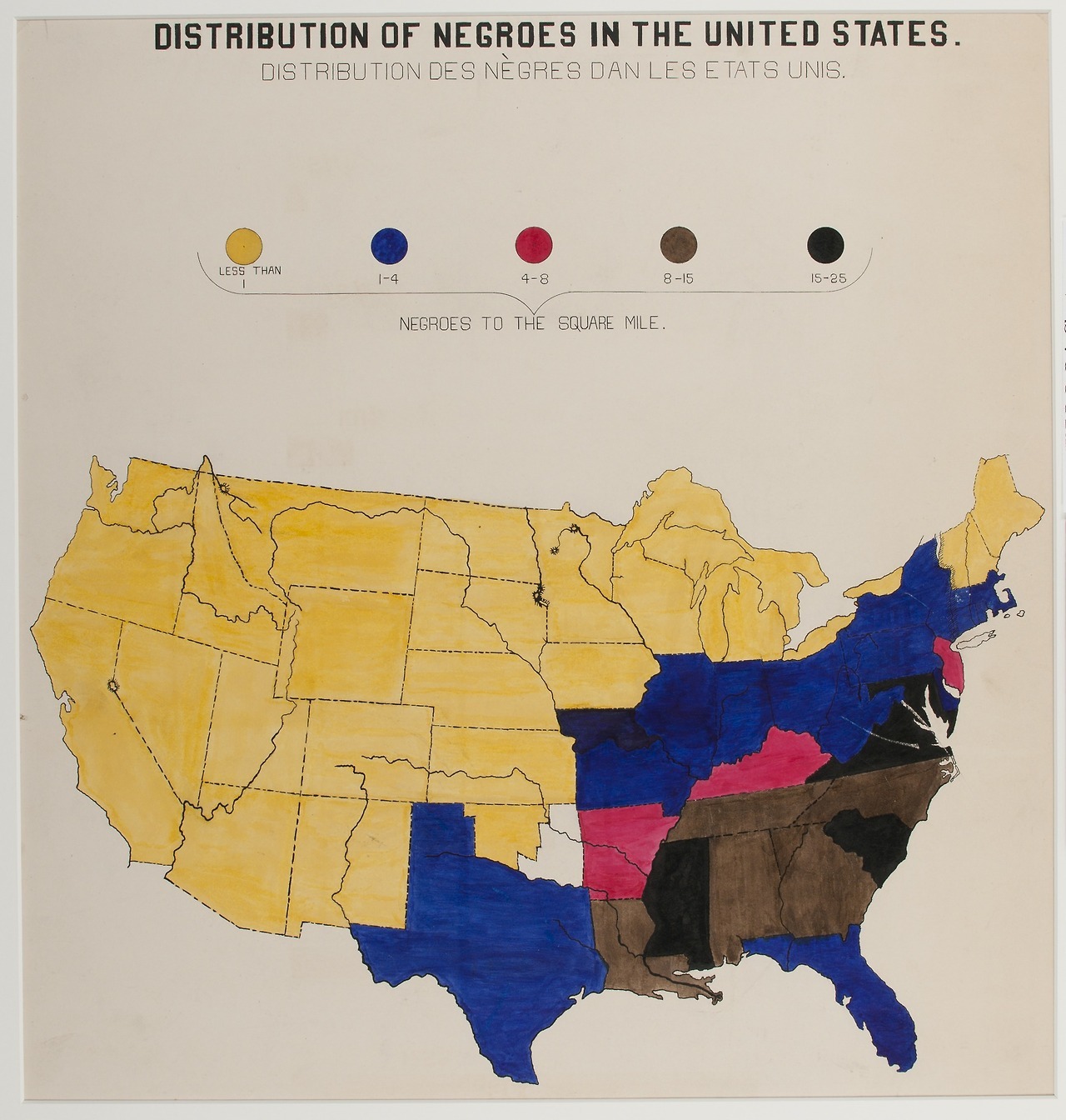
Map showing the African American population distribution in the United States, 1900. Keep reading
Map showing the African American population distribution in the United States, 1900.
I was going to answer the obvious question “what’s up with Oklahoma” by pointing out the Oklahoma Territory (W) and Indian Territory (E) wouldn’t be combined into a state until 1907
But the Oklahoma Panhandle was added to the Territory in 1890, so why is only a third of it there? But then I noticed the PNW and the everything and it’s just a sloppy map
Bonus history: the Oklahoma Panhandle is residue of the Missouri Compromise, Texas had to yield its claims north of 36°30′ in order to be a slave state