Forested area in the United States. Over six years, researchers assembled the national forest map from space-based radar,...
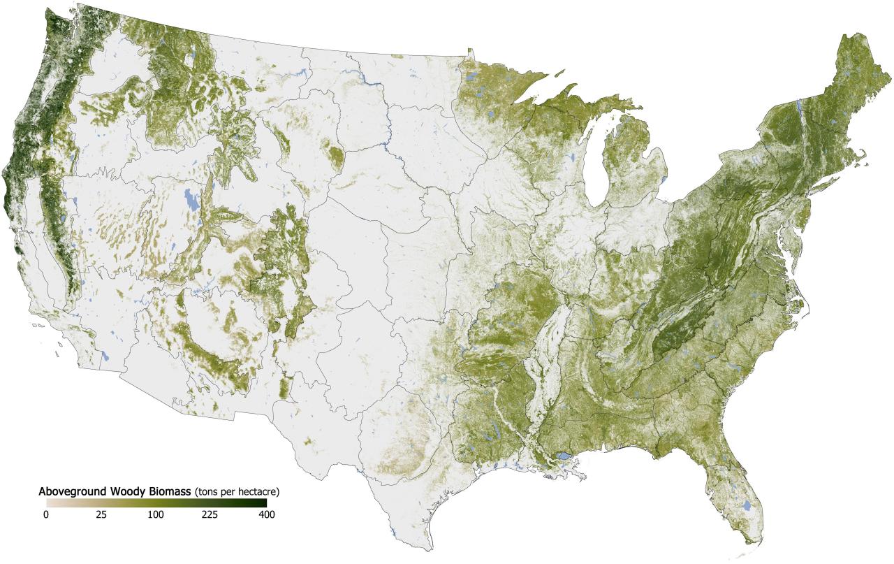
Forested area in the United States.
Over six years, researchers assembled the national forest map from space-based radar, satellite sensors, computer models, and a massive amount of ground-based data. It is possibly the highest resolution and most detailed view of forest structure and carbon storage ever assembled for any country.
Forests in the U.S. were mapped down to a scale of 30 meters, or roughly 10 computer display pixels for every hectare of land (4 pixels per acre). They divided the country into 66 mapping zones and ended up mapping 265 million segments of the American land surface. Kellndorfer estimates that their mapping database includes measurements of about five million trees.